Blog

National Aviary
A photographic trip through Pittsburgh’s National Aviary.
Six minute read & view:
Birds from around the world
A 24-hour journey to my birth town, Pittsburgh, Pennsylvania
And an unusually colored squirrel

(What I believe is) A leucistic Eastern Gray Squirrel on the grounds of Allegheny Commons Park, Pittsburgh, PA | 253mm, 1/250s, f/5.0, ISO 500
On the 51st anniversary of The Immaculate Reception, my friend David and I took a jaunt to Acrisure Stadium in Pittsburgh, PA for what would become a Steelers win! with Mason Rudolph as QB no less against the Cincinnati Bengals. It was December 23, 2023. That was a great experience for one Steelers fan (and the Raiders fan with me, question mark) and was my first time attending a game since my mom was pregnant with me in fall 1975 when at the venerable Three Rivers Stadium. Apparently the stadium that would be imploded in 2001 was only five and a half years old at the time…
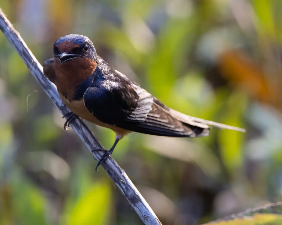
That morning we had time for sightseeing downtown. So we went to Pittsburgh’s Northside and visited the National Aviary, located in Allegheny Commons Park. This very cool place provides an opportunity to see and photograph over 150 species of birds. The official website notes they are “America’s only independent indoor nonprofit zoo dedicated to birds”. The honorary “National” status was enacted into law by United States Congress in 1993, and Wikipedia also tells us this is the largest aviary in the US.

Not actual Love Birds, rather two Saipan White-Eye (Zosterops saypani). Conservation Status NT | 300mm, 1/400s, f/5.6, ISO 4000
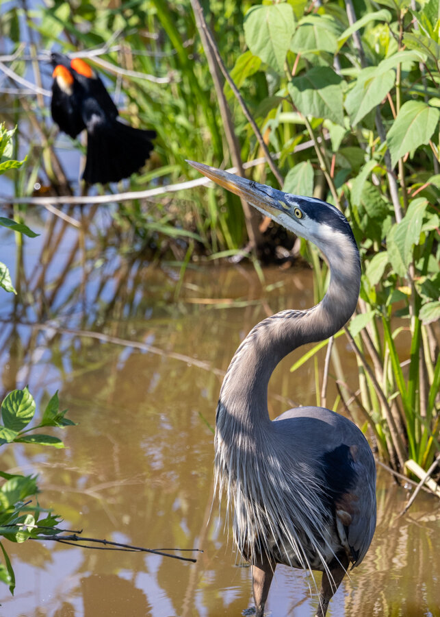
The Aviary has several indoor and outdoor habitats, most of which are viewed from inside. The indoor rooms are conditioned to approximate tropical climate and you enter through a controlled vestibule to prevent bird escape. Once in, the birds are swimming, flying, perching, and in some cases, walking around you. The rooms seemed to vary mostly by size, light level, and whether they have water pools or not. We first visited Grasslands with its many finch- to robin-sized tree perching birds. Other than a couple of single species areas, like the outdoor Eurasian Eagle-Owl and Sea Eagle enclosures, my layman’s assessment is each habitat contains birds ranging from common to rare with native habitats from the United States to South America, Australasia, and Asia. In the Wetlands, where we spent the most time, it was a bit funny to see native Hooded Mergansers, Mallard, and a Brown Pelican (who I understand had been injured and is unable to be released) alongside brightly colored birds like Scarlet Ibis, Blue-bellied Roller, and Venezuelan Troupial.
One guide told me some birds have to be relocated occassionaly to a different room if they don’t get along with another. It got me thinking about what were the designed differences in each room, and how specific are the habitat and food requirements for the different species. But it was very cool to see them all together and be among them, if not while tolerating the Hyacinth Macaw’s constant and very loud screeching. As a photographer, it did feel slightly like shooting fish in a barrel, but it was a great opportunity to see species I will otherwise never get to as well as remove one or two variables surrounding distance and perspective out of the equation which are among the biggest challenges regularly faced.
Bubba, a 26-year old Palm Cockatoo (Probosciger aterrimus) looking very stoic. He reminds me of Sam the Eagle. Conservation Status NT | 472mm, 1/400s, f/7.1, ISO 12800

A Giant Eurasian Owl (Bubo bubo) napping. He was huge! | 270mm, 1/640s, f/5.6, iso 3200
An American Flamingo (Phoenicopterus ruber) in its distinctive orange-pink plumage and unipedal stance. Conservation Status LC | 238mm, 1/1250s, f/5.0 ISO 2500
This vibrantly colored (and aptly named) Superb Starling (Lamprotornis superbus) was captivated by the lens reflection. | 343mm, 1/500s, f/5.6, ISO 12800

A beautiful and royal-looking Victoria Crowned Pigeon (Goura victoria). Conservation Status NT | 223mm, 1/400s, f/5.0, iso 10000

A bird trip wouldn’t be complete without herons. These are Boat-billed Herons (Cochlearius cochlearius). | 109mm, 1/400s, f/7.1, iso 5000

A Scissor-tailed Flycatcher (Tyrannus forficatus) | 343mm, 1/640s, f/5.6, iso 4000

One of many mustachiod-looking Inca Terns (Larosterna inca). They enjoy splashing and chasing around the water hole. | 500mm, 1/400s, f/7.1, iso 10000
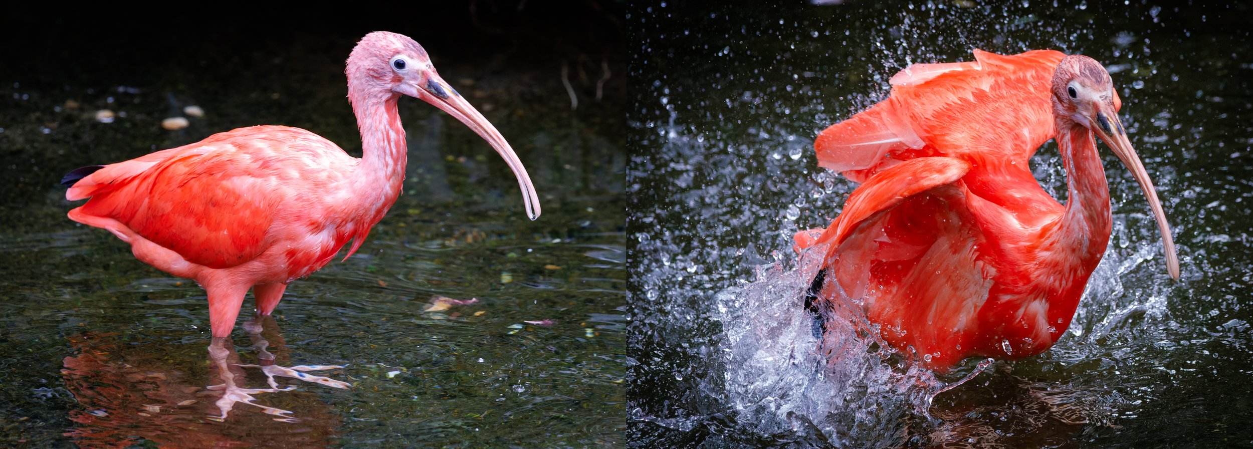
A Scarlet Ibis (Eudocimus ruber) poses, and then takes a bath. His color seems to match the flamingo’s! | (right photo) 238mm, 1/3200s, f/5.0, iso 10000
This Venezuelan Troupial (Icterus icterus) is related to the Oriole, as its’ colors suggest, and are nest pirates. | 500mm, 1/500s, f/7.1, iso 800

The semi-ubiquitous Snowy Egret (Egretta thulapani) having a good, or bad, hair day. Conservation Status LC | 400mm, 1/500s, f/7.1, ISO 5000

A pair of White-throated Bee-eaters (Merops albicollis) nestle on a branch. This an African native species. | 324mm, 1/640s, f/5.6, iso 1000

A diminutive African Pygmy Goose (Nettapus auritus) preening vigorously. | 324mm, 1/400s, f/5.6, iso 10000

A Toco Toucan (Ramphastos toco). I can’t imagine having a long bill to eat my fruit with. | 100mm, 1/640s, f/5.0, iso 3200

One of a pair of Steller’s Sea Eagles (Haliaeetus pelagicus). The beak halo is due to being photographed through glass. | 254mm, 1/640s, f/5.0, iso 2500

A striking Shaft-tailed Finch (Poephila acuticauda), an Australian species. | 343mm, 1/640s, f/5.6, iso 1250

This Blue-bellied Roller (Coracias cyanogaster) seemed to be posing, from Africa. | 428mm, 1/400s, f/6.3, iso 2000

A brightly colored Red Sisken (Spinus cucullatus) in the Grassland habitat. | 400mm, 1/400s, f/6.3, iso 1250

One of two Hyacinth Macaw (Anodorhynchus hyacinthinus), the largest macaw species. They were loud! | 254mm, 1/320s, f/5.0, iso 6400
May you have a fantastic 2024 with many travel - photography - animal adventures!
Music used to create this post: Memphis, Tennessee (Roy Orbison), Une année sans lumière (Arcade Fire), Last Goodbye (Jeff Buckley), Faith I Do Believe (Rusted Root, Pittsburgh’s most famous band?), Delicate (Taylor Swift), Emily I’m Sorry (boygenius).

Epiphany
Exploration of Alberta, Canada’s Rockies and largest city Calgary.
Seven minute read:
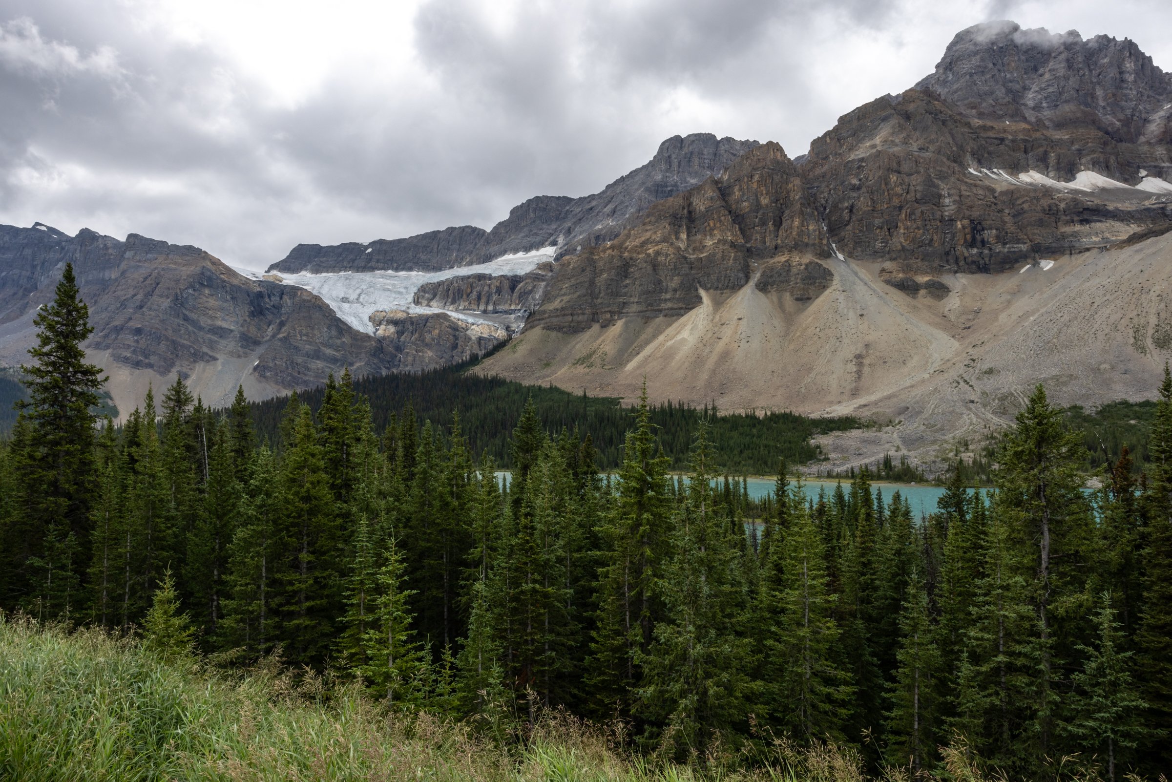
The Canadian Rockies
Lake and waterfall galore
Wildlife
The journey begins with a series of fortunate events
View of Banff from Sulphur Mountain at golden hour | composite, 21mm, 1/100s, f/11, iso 125
299 Miles: Glacier to Calgary
Kalispell, Montana | 48°18'27.0"N 114°15'12.2"W
The few lights of the border crossing at Roosville disappeared in the mirror of our 4Runner rental just after midnight. Since landing at FCA – Glacier International Airport in Kalispell Montana - one hour before and traversing into Alberta, CA we focused on finding somewhere to stay.

Final approach to FCA airport (Glacier Park International, Montana) marks the start of a Canadian Rockies trip | Google Pixel 7 Pro
Surprise number 1.
Thirty minutes earlier – before complete darkness occurred about 11 pm - I had seen a moose with her two calves grazing on the roadside. I had never seen moose before, but it was on the bucket list. My expectations of seeing one over the next 10 days had been both sanguine and restrained, so I left feeling energized. This was a positive omen for our trip.

A wildfire hotspot on the hill west of Sparwood | Google Pixel 7 Pro
Surprise number 2.
At 1 am, while passing through the village of Sparwood, we saw hotspots of forest fire on the east facing slopes to our left, about a kilometer away. Not raging infernos as I had imagined from the regular reports of Canadian fires earlier in the summer, but quiet, amorphous red-orange flickering blobs. It was difficult to understand the scale because of the distance and darkness. There were fire fighting vehicles on the service road where I pulled off to try to get a cell phone photo. This time it felt eerie and foreboding, the total opposite of before.
Around 2 am, having being told at a dozen motels ‘no vacancy’ – for reasons we could not figure – we decided to keep on trucking to our reserved room in Calgary. That was a vestige of our original travel plans just 48 hours earlier before I realized Kate’s passport had recently expired. To make our journey to Banff and Jasper happen we would have to drive across the boundary with two passports and one birth certificate.

I awoke to this pre-dawn view of the Aurora Borealis from the Cowboy Trail | Google Pixel 7 Pro
Surprise number 3.
Around 2:30 am, thoroughly exhausted, we pulled onto a pull-off lane of Highway 22 “Cowboy Trail” northbound to take a nap. With the engine and lights off the air was utterly still and totally dark. At 3:15 I woke to the high speed woosh of a passing truck, still tired but after several minutes, awake and feeling refreshed enough to continue. Then I looked up for the first time, thinking I saw the first signs of dawn on the horizon. But after rubbing my eyes thoroughly and a moment of confusion, realized it was not astronomical twilight before us, but the northern lights. This time I felt exhilaration. I had no expectation for seeing the Northern Lights in 2023. Our latitude was a lowly 49°52'. But the time and the conditions of the magnetosphere that particular day proved to be serendipitous.
Calgary
Calgary, Alberta | 51°02'41.2"N 114°03'11.3"W
Kate uses her first SLR camera at Calgary’s National Music Centre museum (aka Studio Belle) | 14mm, 1/80s, f/7.1, iso 100


Moraine Lake
Banff National Park | 51.3217° N 116.1860° W

Mid-morning light drapes across the peaks east of Moraine Lake | 30mm, 1/80s, f/14, iso 160
The turquoise water of Moraine Lake viewed from The Rockpile | 23mm, 1/100s, f/10, iso 100
Canoers on Moraine Lake | 472mm, 1/400s, f/10, iso 320

An American Pika (Ochotona princeps) smiles for the camera | 500mm, 1/1000s, f/7.1, iso 320


Mount Edith Cavell
Jasper National Park | 52°40'06.0"N 118°03'24.0"W
Ancient layers of ice and glacial till rise beyond Cavell Pond | 100mm, 1/100s, f/9.0, iso 100

The trailhead seat and sign | 23mm, 1/80s, f/6.3, iso 100

Green lichens (living) and gray (dead) cover the rock outcrops throughout the meadows | 500mm, 1/125s, f/7.1, iso 100
Angel Glacier and Mount Edith Cavell | composite, 23mm, 1/50s, f/14, iso 100


Ice, abstracted | 472mm, 1/250s, f/9.0, iso 100


Mistaya Canyon
Icefields Parkway | 51°57'01.0"N 116°43'00.0"W

The Mistaya torrent rushes through narrow canyon walls toward the North Saskatchewan River | 35mm, 1/20s, f/13, iso 100

A subalpine forest of Douglas Fir (Pseudotsuga menziesii) | 42mm, 1/40s, f/9.0, iso 160


A Columbian Ground Squirrel standing sentry next to his burrow beneath a picnic shelter (Urocitellus columbianus) | 472mm, 1/1000s, f/7.1, iso 5000
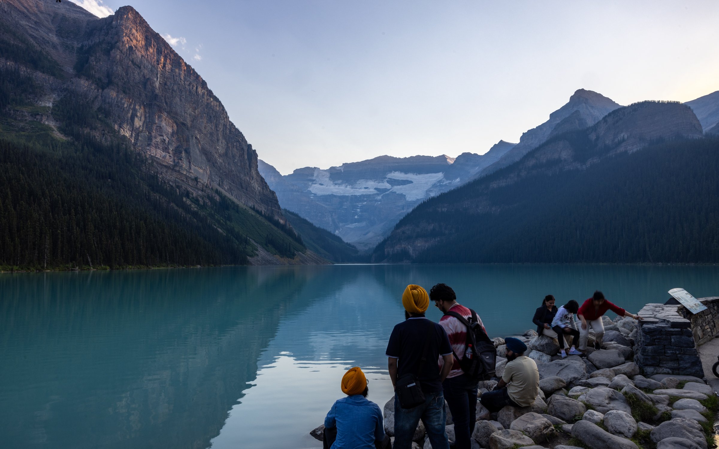
Lake Louise
Banff National Park | 51°24'42.0"N 116°13'41.0"W
Lake Louise is a magnet for activity at sunset | 23mm, 1/25s, f/22, iso 100


Dining at the Fairmont Lake Louise | Google Pixel 7 Pro

A cantilevered trail through nearby Johnston Canyon | 31mm, 1/30s, f/13, iso 100
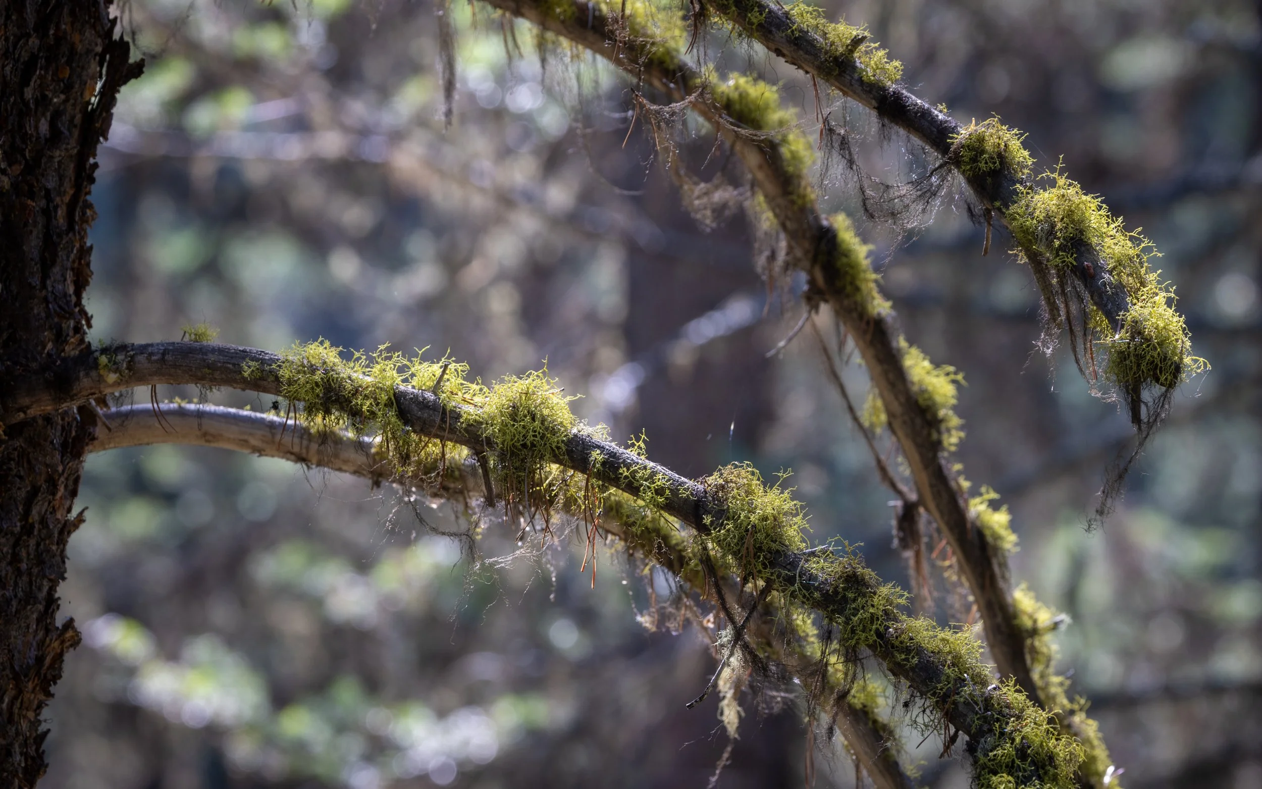
Moss in the tree canopy | 254mm, 1/40s, f/8.0, iso 100
Banff
Banff National Park | 51°09'53.1"N 115°33'46.7"W

Photo op in the Cascade of Time Garden with downtown Banff in the background | 25mm, 1/320s, f/8.0, iso 320

Gondolas arrive at the summit of Sulphur Mountain above Banff | 27mm, 1/80s, f/9.0, iso 200

O Canada | 25mm, 1/100s, f/10, iso 100

Brown and Black Bears are not uncommon in the Canadian Rockies | 35mm, 1/80s, f/4.0, iso 100
Orange lichens adorn a white rock at Cave and Basin National Historic Site | 19mm, 1/20s, f/4.0, iso 1000

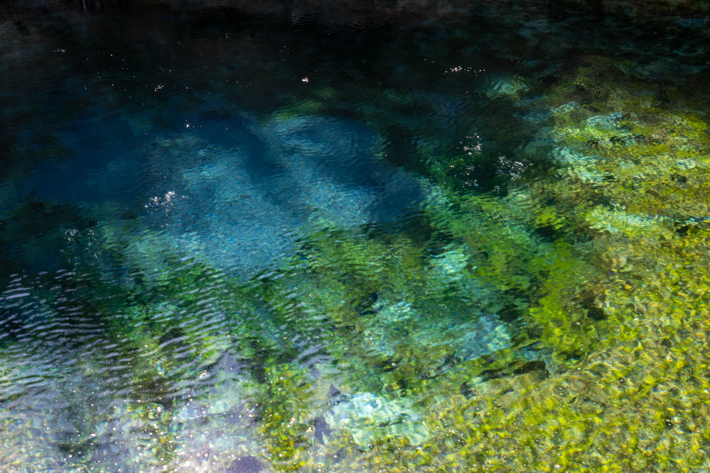
A sulfurous pool at Cave and Basin National Historic Site in Banff | 19mm, 1/10s, f/4.0, iso 2500
Rotten eggs were on the menu at this hot spring | 35mm, 1/25s, f/20, iso 100

Park Canada distance signage | 123mm, 1/320s, f/8.0, iso 100
Canoers on Lake Minnewanka | 100mm, 1/500s, f/10, iso 160

Hotel view | Google Pixel 7 Pro
Jasper
Jasper National Park | 52°53'09.1"N 118°03'27.2"W

An American Crow (Corvus brachyrhynchos) among elderberry (Sambucus canadensis) foliage | 451mm, 1/250s, f/7.1, iso 100

Pyramid Mountain as seen from a group canoe, Lake Beauvert at Fairmont Jasper Park | Google Pixel 7 Pro

Horseback riding through a birch grove | Google Pixel 7 Pro

Rounded river stones in a point bar of the Athabasca River | 35mm, 1/50s, f/10, iso 100
Athabasca Falls | 14mm, 1/50s, f/20, iso 100

Horseshoe Lake, one of many stops along Icefields Parkway | 25mm, 1/100s, f/14, iso 100
Peyto Lake in late afternoon | 22mm, 1/100s, f/16, iso 100
Music used to create this post: Black Muddy River (DeYarmond Edison), Scott Street (Phoebe Bridgers), So Now You Know (The Horrors), Jetstream (Doves), Wish You Were Here (Pink Floyd)

The Case for (good) Tree Pruning
As spring approaches, a reflection of landscape pruning practices, land use patterns, tree preservation during redevelopment, and anticipation of baby eaglets.
Ten-minute read:
Local eagle parents-to-be
Creative tree trimming
Site planning vs engineering
Juniper palms
Contracting with inadequate training and knowledge
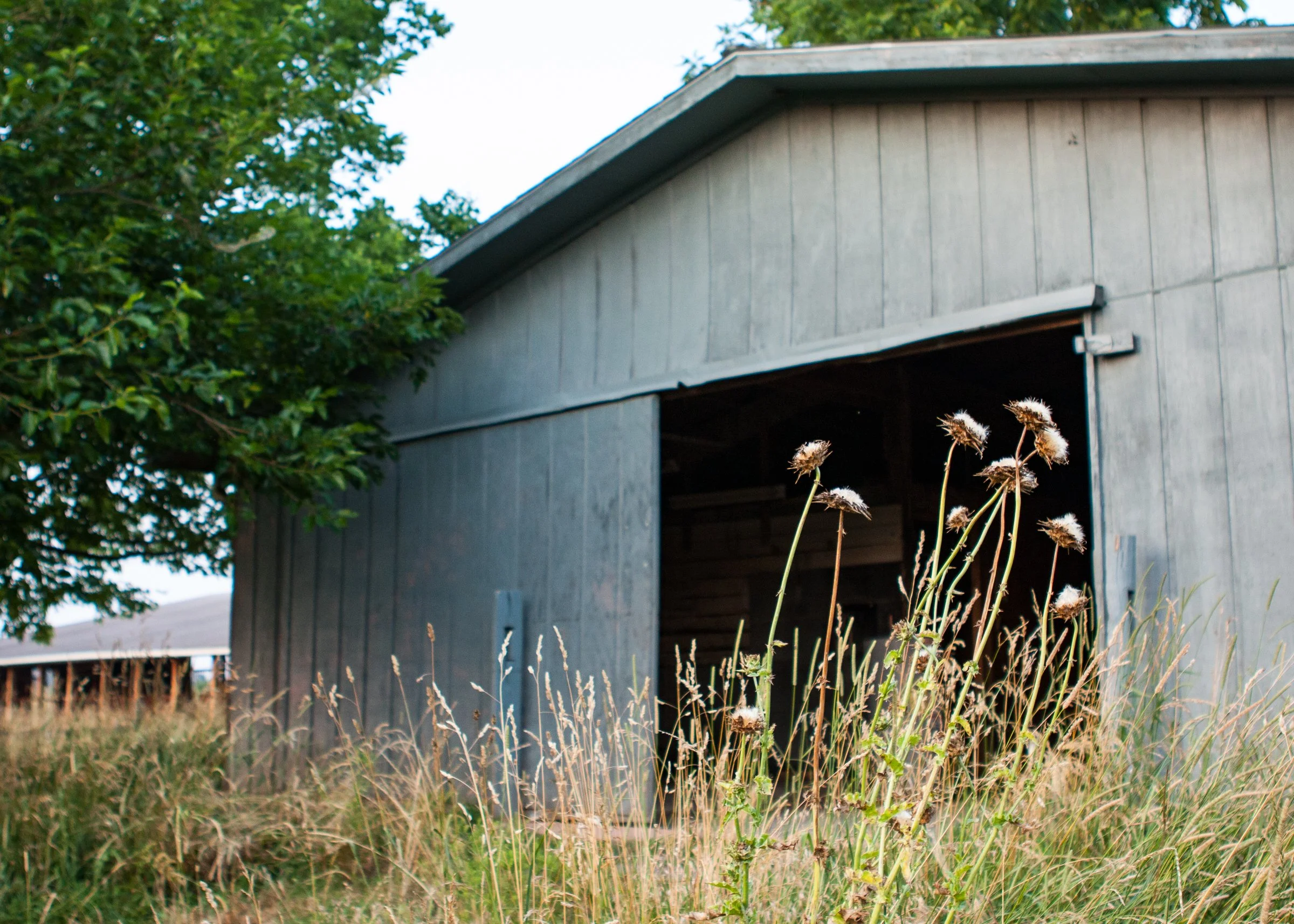
Pre-Brambleton abandoned horse barn and home
Looking forward to spring
I have noticed, as a landscape architect for 18 years and a Certified Arborist for half of that, that the disfiguration of our landscape trees has become more common. Three images below show creative, yet undesirable, examples of tree pruning. Have you noticed these local sites, or do these things go mostly unseen?
These are the Wegmans Pears, the UHaul Juniper Palms, and the Chantilly Shell Buffer Trees. In fairness, a commercial leasing and management firm, not Wegmans, probably owns the development where the pears are located.

A row of Juniper Palms. and one Magnolia Palm. I coined these terms (palm trees are more closely related to grasses, not evergreen trees) after seeing this unique pruning technique. The maples and other shade trees are also limbed up unnaturally high to maximize visibility. 70mm, 1/400s, f/8.0, iso 100
The Tree Care Industry Association puts it simply: pruning is much more than the simple act of sawing off limbs. Yet you have only to drive a few miles to see some exceptional examples of the wrong way to prune. Some are not maintained enough; some are maintained just fine.
As we begin to see a return of spring on the distant horizon with its warmer days, fledgling eaglets, lawn cutting, and other fun things, I’d like to consider these and how they may relate to re-fresh-ing our personal spaces. Dave, are you making too much of this? Tree trimming isn’t rocket science – true. I see a two-fold issue. The first: proper pruning requires knowledge of tree biology and standardized safety practices. Doing it without these results, in the worst-case, in injury or property damage. More often it introduces stress and wounds which predispose trees to disease, pests, and shortened life. That leads to less and less healthy tree canopy, lower property values, worse community appearance, lower bird insect and animal habitat, etc.
Now is the best time to prune most types of our own trees. If you have not in the past, consider the landscape construction and maintenance professionals through who you, as business and home owners, hire for improvements. Consider writing your elected officials to support zoning ordinance adjustments which lead to higher quality landscapes in the long term, while not imposing unnecessary restrictions. Ask contractors if they have ISA Certified Arborists on staff who will oversee or perform pruning work, and only hire those which do. Hire impartial 3rd party arborists to provide assessments before hiring the firm who will do the work.

A recently pruned Bradford Pear (Pyrus calleryana ‘Bradford’) with many heading cuts. The plane trees in the background have not been recently trimmed. 147mm, 1/400s, f/8.0, iso 125
The second is broader: Why do we tolerate this; do we not see it? I don’t mean each individual instance, but as a whole, over time, through market forces, collective decision making, and shaping of regulations like ‘who is qualified to be working in the community as a tree pruner?’
I think we perceive poor landscape choices, which can include pruning, when trees look and are unnatural, even if we aren’t consciously aware of exactly what’s wrong. Do we not gain enough knowledge and appreciation of plants and tree science, something intrinsic to humanity, in the 12 to 16+ years most spend in schools? I believe so. If it’s important to us, enough of us will find a way to incorporate more into our curriculums and lifelong interests.
It might be part of a larger question of how our developments (offices, shopping, data centers, housing) are shaped. On the one hand, development of the land can be planned with real consideration for its character, ecology, surrounding context: the communities’ vernacular. M-W defines this as “nonstandard language or dialect of a place, region, or country”. What is the vernacular of Ashburn, Loudoun County, or Northern Virginia? Is it embodied in the architecture of Oatlands and the homes and barns along Snickersville Turnpike? The villages of Middleburg, Waterford, and Leesburg? The Point of Rocks bridge and (former, for now) White’s Ferry? Is it the stacked stone walls and three-board fences that are common through Aldie and the Rt 50 corridor, and the rolling bucolic landscapes they enclose that are still so common to the middle and western parts of Loudoun? Perhaps those are our most famous examples, or maybe it’s also much more.
I am not suggesting modern development should look like Oatlands, or be comprised of authentically replicated stacked-stone walls. I am only asking what is the identity of Loudoun, the Blue Ridge District (a question in a question), Ashburn, and Brambleton? What is the meaningful inspiration guiding the shape our community today takes? Is it authentic, is it desirable, or do we want more; should we expect more? Read about local limestone caves and quarries, and other interesting historic stories.
The Dulles Expo center was one of the first ‘landmarks’ I saw on an early foray to the region’s eastern reaches. To me, its warehouse-scale architecture and imposing parking lot with islands of mostly struggling trees epitomize development we should not want as a source of community identity. To be clear, I love Brambleton and find it to be a well-planned community situated towards the high end of spectrums spanning livable vs unlivable, beautiful vs unattractive, safe vs dangerous, desirable vs undesirable.


Back to land planning, the other way development of a parcel of land can occur is by being highly engineered, massively transformed to maximize productivity and with little regard to surrounding context, environmental considerations (for example, taking advantage of natural sun and shade patterns for energy efficiency), and human factors that might make it otherwise more attractive and desirable places. Land is valuable. I get why someone thought building two to three tiers of 12-foot high segmental retaining walls to allow more pad sites for quick-service restaurants, a big box store, and nail salons would equate to more rentable revenue. But I don’t know why we and our zoning ordinances and planning commissions, or in the case of when zoning does not allow this development by-right, our Commissioners who approve such special exceptions, allow or encourage these land-use patterns.
Data centers may make a locally appropriate case study. Personally, I think there’s lots to like about them - they don’t require much parking, they don’t generate many trips (once dump trucks finish hauling the construction materials and waste away), provide good tax revenue, and don’t require more schools in a world that will never have enough. I have a friend who abhors every single data center, but I think there is at least one ‘good’ looking one for every three really bad. The ‘good’ ones, when clustered together in industrial districts, using good site planning practices, with their required-by-zoning plantings placed at a sustainable density (i.e. not becoming overgrown after 5 years) using properly-amended soil (i.e. some topsoil content) is a perfectly fine land use which can fill a welcome niche within our community. Many of the issues I described were raised during the recent Loudoun countywide zoning update process and I think those tasked with leading the process tried to address some of them.
Land development should strike a balance between landowner rights and the needs and values of the entire community, which do evolve over time. In an imperfect world, we still have lots of room for improvement on both sides of that balance.

Horse riding stables in 2010 located at current day Tradewind Dr and Evergreen Mills Rd, Brambleton. More images available below in the gallery. 34mm, 1/320s, f/2.8, iso 400
Not long ago, when I moved here in 2009, I was able to explore abandoned horse barns, homes, surrounding woods and old farm fields. In these last two, many had their own remnants of old settlement - rusted-farm implements, metal refrigerators, other junk, and landscape plants of old, now wild but distinctly non-native plants which were popular during eras of colonial exploration and made available to all. Things that, like everything culturally cyclical, pre-date our current priorities, such as the native plant craze: Amur Honeysuckle (Lonicera mackii), English Ivy (Hedera helix), Autumn Olive (Eleagnus sp.), and Mulberry trees (Morus sp.) You can read more about the intersection of non-native plants and our natural landscapes here.
I’ve seen the same items - and they’re quite fascinating as a window into our local history - walking the less-traveled western side of Beaverdam Reservoir, which was created by impounding Beaverdam Creek just off the higher-order Goose Creek, in 1972. Now many of these abandoned homesteads have been consolidated and turned into new homes for many like myself in Brambleton - a process which has happened countless times across America as our rural areas evolve - and disappear, for better or for worse - over time.


A far larger issue than improper tree pruning surrounds a holistic lack of planning, consideration, and knowledge of how to preserve trees during development and re-development. This is more acute in Virginia, which has no state-level forest conservation law that can trickle down to local jurisdictions, as Maryland does. Trees are indiscriminately removed, their structural roots trenched within feet of the trunk, crushed by heavy equipment driving over the soil, and otherwise disfigured. These all significantly wound, deprive roots of air space, eliminate the ability to balance moisture and nutrient uptake with leaf transpiration, and in turn open the door to insect and disease proliferation. Development is a given (though I wish there was more private land conservation, perhaps a future blog topic). But it would not be significantly more expensive or difficult with adequate foresight and planning to maintain and incorporate more canopy and individual healthy trees in our built landscapes. And that would exponentially increase the value-added of redevelopment to the community at large.
Some Northern Virginia jurisdictions have urban foresters who review commercial and institutional projects during the permitting process. Most require some level of tree canopy area replacement. But, as I describe below, this seldom results in a one-for-one exchange between pre- and post-development conditions. Stands of large (let’s say 24-inch trunk diameter and larger) red and white oaks (very often) in fair to good condition are cut down and many small (3-inch) trees are planted and, because of cultural (site) conditions, most will never get close to 33 percent of the size and ecosystem services provided of the removals.

Nursery grown and mature preserved trees at a recently completed landscape project, Ashburn, VA.
50mm, 1/100s, f/4.0, iso 100
Fewer jurisdictions have regulations requiring meaningful accounting of existing tree conditions, and fewer still have influence over how much those to remain are impacted or methods of protection. Fairfax County is an exception to this approach, and actually, more than others their rule that requires permits document trees on the neighboring property be considered can reduce the likelihood that those are not significantly impacted, where they might eventually catastrophically fail. Arlington County focuses on replacement of lost individual trees, but their urban foresters are very knowledgable and this often leads to more meaningful preservation which is the goal I think is key. Generally, less regulation is better than more. But there are decades that show us that this is not a priority for planners and landowners in enough cases. Tree canopy is a significant public good that should be fairly and reasonably regulated.
The net result of landscape design for commercial and institutional sites (and in many residential developments) is very often some combination of suboptimal plant selection for the open, harsh sun and wind conditions that will characterize the site, planting in poorly draining, inadequately amended media that is devoid of topsoil (which is usually stripped and removed during site demolition), and maintenance practices which focus on mowing and fertilizing turf, mulching (and over-mulching, because it is good business for commercial maintenance firms), bulk-pruning twice a year, over-irrigating (by not adjusting application rates after the initial period) if there is irrigation (and when it’s not the palette of durable options is limited), and spraying for insect and disease problem occurring because of the wrong-plant, wrong-place approach taken rather than one of true integrated pest management which would otherwise ameliorate subpar conditions. Wow, that sounds pessimistic. But unfortunately, after 18 years of first-hand experience, this is very often true when there is no landscape architect involved and / or an owner without an understanding and motivation to create a dynamic landscape, or a property manager (in the case of retail) motivated to create a place attractive to their targeted consumers.


I became an urban forester to become a better landscape architect - to integrate the processes of assessing a site to better value and determine which trees or tree stands might be best preserved, and then to design the development around them better. And understanding methods that lead to more success in preservation when the contractor mobilizes their materials and equipment on site. There are growing numbers of LA’s who have done the same, including some who previously worked on my team. I applaud them all. Today, I’m experienced in how development and preservation can work well. Unfortunately, there are only a handful of expert consultant leaders who really focus on this full-time (which I do not). They can be the tip of the spear in developing new methods and technologies, promoting and inspiring communities to do better. There are even fewer contractors who understand and can implement methods successfully, though the numbers have improved over the past decade as permit requirements have strengthened. All of these are very rare outside of the MidAtlantic in many areas of the US. There are many opportunities now - possibly in part as a result of COVID - for professionals and others to learn about many aspects of management of trees and their environs. Tree Fund is one, hosting regular online webinars. Trees Virginia is another which is local and has in person sessions. Urban foresters in the local agencies, as well as the Cooperative Extension Service (which has a branch in each county), are positions we fund through our tax dollars - they are very knowledgeable and good resource options.
My suggestions to help bolster the extent of healthy canopy around us, our collective general knowledge, and professional specialized understanding includes these points: 1. Tree biology should be a core part of school curriculum. 2. Many planners and owners should take a greater interest and commitment to understanding the benefits of trees and forest on their property. 3. They should hire landscape architects, tree assessors, and preservation experts early in the design process to extract the most intrinsic value from their sites, where appropriate, while contributing to a more fecund and resilient community. 4. Every contractor should have a qualified tree preservation arborist subcontractor whenever the larger team comprised of consultants and owners have determined there are existing which are to be protected. 5. The community at large should participate in the public review process (such as during special exception applications) and urge for more thoughtful incorporation of existing healthy canopy in redevelopment - not saving trees merely for their own sake, because that isn’t very realistic, but because many of our developments can be improved through the design and construction processes.
I welcome further discussion on this topic because it is complex and I certainly don’t have all the answers. I may also adjust my own perspective tomorrow from new ideas and considerations. There is no one right way to develop land, particularly something so unique to geographic, economic, and cultural conditions.

A heavily pruned row of alternating Red Maples (Acer rubrum) and River Birch (Betula nigra). The closest tree has a strap which will soon cause girdling and eventually kill the tree if not removed. The trees also have many wounds and poor past prune cuts.
104mm, 1/125s, f/8.0, iso 250
In terms of re-freshing and that verdant spring on the horizon, my family has recently enjoyed watching the Dulles eagles at the 149-acre Greenway Wetlands. Their one-ton nest sits atop a tree few miles west of the Wegmans Pears. The female laid two eggs recently and she is a very good mother-to-be, diligently incubating and using her hooked beak to pull soft grass bedding close to her body. Turning on the webcam and listening to the cacophony of woodpeckers, goose flocks migrating north, airplanes 3,000 feet above, the quiet din of rush hour traffic in the distance in the background is quite relaxing. Now that the community has decided on the parent's names, we look forward to (hopefully) seeing them hatch, grow, and fledge in a matter of weeks. That will be a very unique sign that spring has arrived.
Music used to create this post: The Suburbs (Arcade Fire), Some Cities (Doves), The Gash (The Flaming Lips), A Passage to Bangkok (Rush), Carolina (Eric Church), Love Song (Miranda Lambert), Take Me Home (Phil Collins)

From Zeus to Helios
A 96-acre post-war antenna array in rural Maryland becomes a unique local spot for flower watching.
Eight minute read:
Public land conservation and wildlife management.
The first detection of extra-planetary radio signals.
Sunflowers
Rural Maryland lowlands, near the town of Poolesville.

A woman and her dog stroll along field #1 at McKee-Bershers Wildlife Management Area one late July afternoon. 32mm, 1/125s, f/10.0, iso 320
On the advice of my good friend, architect and enthusiast photographer (and amateur chef) David Belgin, I recently visited McKee-Beshers Wildlife Management Area. Here, along Maryland’s rural lowlands paralleling the Potomac River, is a network of managed sunflower, sorghum, and wheat fields cut in among hardwood and pine forest. Wetlands and a few dog training fields are sprinkled in for good measure. These are state-owned lands, managed for wildlife and accessible to the public. Maryland Department of Natural Resources (DNR) grows crops as a food source for mourning doves, songbirds, and, from what I could tell, many thousands of bumblebee pollinators. Beginning in September, certain fields open during select times for dove hunting, just as they are at fifteen other WMA’s across the state into winter. The lands are park-like but in a satisfyingly undeveloped way.

A field of sunflowers looking west in the late afternoon. 8.38mm, 1/2000s, f/2.8, iso 110
Many others were visiting the fields during my trip - not a constant stream, more of a flow and ebb. Couples, a group of 20-something women in white dresses which I thought might be part of a wedding photoshoot (but when they wandered through the tall sunflowers, I wasn’t so sure), mother and daughters, whole families with young kids, others like myself with a camera and carrying a stepladder, top rung over their shoulder, and a few individuals. As I arrived at the gravel lot and sat in my car protected from heavy drizzle that was starting to dissipate, I reviewed the online map again to get oriented for a three-quarter-mile walk to one of the four fields. A closed vehicular gate served as a rallying point, many pairs and threesomes circumnavigating it to begin or end the journey into the 14 parcels that I later learned were joined over 40 years. Seeing the well-visited park, it seemed like a distinct possibility I was just coming into a not-so-well-kept secret.

An artichoke-like bud beginning to open. 70mm, 1/60s, f/11, iso 800
Looking at Google Earth’s historic imagery, aerials of this site show it has remained virtually unchanged for seventy years. The exact same field clearings among the same forested lands. Mr. Jim Bennett, Central Region Manager for DNR’s Wildlife and Heritage Service told me that the first two parcels were purchased in 1951 from the McKee family. In 1953 more acres were acquired from the Beshers family, hence the name of the WMA. First mystery solved. The last parcel was purchased in 1990.
One difference I did notice though from reviewing the images, wetlands appeared to be ponds filled to the brim in 1995’s version, internal farm roads containing the waters which read like smooth black masses. In other years though, these same areas look like Petri-dishes of bacteria growth, a mosaic of many different pea, olive, and forest-green blooms spread out, indicating puddles among desiccated mudflats. Perhaps the difference in overly wet and dry years. Re-reading Mr. Bennett’s message led me to question this assumption though.
One of the tools of land management he said that is used at McKee-Beshers are Green Tree Reservoirs (GTRs). Being an arborist planning for tree preservation during development (as part of my landscape architectural projects) and not trained in forestry which is all about the management of large stands of trees and timber production, this concept is new to me. Essentially, lowland forested areas or grasslands can be impounded during winter for periodic flooding. This simulates an increasingly less common natural cycle along stream and river valleys, less common because of flood control measures and loss of habitat from greenfield development. Studies of the best practices for GTR periodically reveal new insights. A balance must be struck in the amount of soil saturation so the forest stand’s health and composition are not compromised. If started too early, pin and other red-oak types that provide a valuable acorn food source and forest structure may die. But benefits, back to Mr. Bennett’s message, are improving wintering habitat for waterfowl and play a part in how they keep certain areas in early successional form. I am unsure where at McKee-Beshers GTRs are managed, but would be very interested to see them in action with ducks and geese. So maybe the variation patterns seen in the aerials for so many decades are part Mother Nature - part land manager driven.

A field of sunflowers looking west in the late afternoon. 254mm, 1/125s, f/9, iso 250, 80% crop
It turns out that McKee-Bershers had a different angle to its story in the mid-20th century. Much like Huntley Meadows in Alexandria was formerly used by the US Navy for information gathering purposes as I described in June, the Poolesville, Maryland site has a technological story of its own in the Mills Cross Radio Telescope. An article in The Astronomical Journal in 1955 describes a 96-acre two-dimensional array with “two crossed 2047-ft. arrays of 66 dipoles each”. The device set up by the Carnegie Institution of Washington was essentially two long electrified cables mounted with sensors pointing east-west and a wire mesh backing. The voltage could be adjusted in order to scan a particular part of the sky and, in return, collect bursts of radio noise. The main source of the disturbance they identified was near the Crab Nebula.
Scientists Bernard Burke and Kenneth Franklin “concluded that the radio noise is associated with Jupiter… in events in its atmosphere similar to terrestrial thunderstorms.” They determined this largely from the timing of the bursts they recorded, which aligned with the time for one rotation of Jupiter - once every 10 hours. “Astronomers had never picked up radio signals from any planet besides Earth.” The juicy details are described in more detail on NASA’s website. The oldest historic aerial I found is dated 1957 and shows a large X immediately west of what is today Field #2. You can see it today by searching for the coordinates 39°04'41.5"N 77°23'36.7"W. The next available image I found is dated 1963. In it the X pattern is no longer visible, though some nearby structures which no longer exist today did still remain.
Jupiter is the 5th and largest planet in our solar system. Jupiter was considered by many Romans to be king of the gods, and equivalent to the Greek god Zeus.

A woman and her daughter examine some flowers up close. 70mm, 1/100s, f/11, iso 640
According to the Old Farmer’s Almanac, 2021 is the Year of the Sunflower. Annual-type sunflowers, those which complete their life cycle in one year, have been domesticated for thousands of years, and are native to the Americas. Sunflowers are in the Asteraceae family, a huge taxonomic conglomerate of over 30,000 species of flowering plants including Asters, Lettuce, Artichoke, Chrysanthemum, Dahlia, Artemesia (absinthe), and the infamous Ragweed.
A characteristic of the family is that each ‘flower’ or capitula is actually a collection of hundreds of small true flowers called florets. The large petals around the center are purely decorative (directing bees and other pollinators to the treasure they hold) and have been bred to various cultivars having different colors and sizes. I estimated the variety at McKee-Beshers to each have roughly 1,200 florets or, eventually, seeds. I found this article with a pretty detailed and interesting description of the life cycle of an annual sunflower. See “Stage 7. Seed Development” for a photograph of mature seeds ready for harvest from the flower.

Mature sunflower flowers facing east in late afternoon. Morning sun draws in pollinators. 24mm, 1/100s, f/11, iso 500, B&W Split Tone.
Sunflowers are a perfect example of heliotropism. Each flower follows the sun’s movement throughout each day, at least while the plants are actively increasing in size and their stems remain pliable. This time-lapsed swaying east to west occurs as they grow faster on the side the stem is exposed to direct light, as described in an article by UC Davis. Once the plants reach full size, as in the ones at McKee-Beshers during my visit, they will continue facing east even in the late afternoon. By facing east, they benefit from first exposure to the early morning sun, which warms and attracts more pollinators. In experiments, flowers that were forced to face west in morning received fewer visits.
What birds are likely to seek out the sunflowers, corn, sorghum, wheat, and acorns during fall and winter? I’ve just recently tried to wrap my mind around the bird family tree, I think they will fall into four main groups: upland game birds such as Pheasant, Quail, and Turkey (the Galliformes), Mourning Doves (Columbiformes), Goldfinch, and other songbirds (passerines), and waterfowl like Mallards, Wood Duck, Canada Goose, and Bufflehead (Anseriformes). Some of these birds and the rodents which are likely to also benefit from all the protein, carbohydrates, fats, and mineral goodness may, in turn, attract Osprey or Bald Eagles (Accipitriformes) from the nearby Potomac River. A regular palustrine circle of life.
By the way, the sun for which sunflowers are named is of course the star at center of our solar system. Many ancient Greeks considered Helios to be god and personification of the sun.

Sunflowers may have over 1000 florets, which develop into over 1000 seeds. 400mm, 1/125s, f/6.3, iso 125


Music used to create this post: Ignoreland (REM), Alligator (Of Monsters & Men), It Can Happen (Yes), I Know The End (Phoebe Bridgers), Get Out (Chvrches)

Farewell Brood X
Who will be president during the next major visit of the periodic cicadas?
Five minute read:
Gravel cycling Virginia’s rural roads with friends.
A timeline of US Presidents in office during emergence of Brood X cicadas.
Physiography of western Loudoun County.
The quaint village of Unison.

The molted exoskeleton of a Brood X cicada, Magicicada septendecims, clings beneath a branch. 428mm, 1/125s, f/6.3, iso 2500
This past week my friends Mike, Harold and I heard the shrill calling of the last remnants of Brood X periodical cicadas. We were Saturday morning biking along Virginia’s scenic gravel roads near the village of Unison.
Our 18.5-mile gravel ride through this beautiful bucolic countryside sits at the far western reaches of the Foothills physiographic subregion of the Piedmont, right about where it transitions into the Northern Blue Ridge province. The topography and soft surfaces provide challenging but really beautiful rides every time. Loudoun County has “Virginia’s largest network of rural roads”, according to America’s Routes, an organization dedicated to supporting their discovery, experience, and preservation. If you haven’t walked, cycled, horseback-riden, or at least driven on these lightly traveled country lanes, then you are probably missing out on a unique experience.

Stacked stone walls are familiar vernacular parts of the Middleburg, Virginia area landscape. 33mm, 1/250s, f/8.0, iso 100

This is horse country. Board-on-board fence and rolling topography are also ubiquitous. 31mm, 1/250s, f/7.1, iso 160
Our ride took us from an elevation of approximately 450 up to 650, with a total gain of around 1,300 feet once you account for all the downs and ups. The cooler undeveloped reaches through pasture and hollows resulted in a meaningful delay in emergence and, eventually, petering out of Brood X compared to other places. Like those closer to sea level and urbanity, eastward in Leesburg, Fairfax, and Washington, DC. More quantitatively, degreedays.net indicates that Leesburg, VA had 15.2 days warmer than 80 Farenheit in the previous month up to the day of our trip. This compares to 10.4 in the Town of Winchester which is about 35 miles to the west. Degree days are used to predict and benchmark plant growth (such as Tidal Basin cherry blossoms each spring) among other agricultural and energy use metrics.
Pennsylvania Quakers settled the town of Union, Virginia around 1740 and it was chartered by the Commonwealth in 1813. Unison became the official name in 1829 when the post office, having been previously discontinued, was reinstated but renamed on account of another Virginia town in Monroe County also named Union. Later, action in 1862 initiated by Confederate Calvary under JEB Stewart in Unison reportedly delayed Union forces to the benefit of Lee’s army. They were able to eventually take position around Fredericksburg and bolster the protection of the capitol in Richmond. This was a last straw for President Lincoln, who, greatly frustrated by repeated lost opportunities, removed General McClellan from command. By the 1870s, the establishment of the Washington and Old Dominion Railroad several miles away from Unison contributed to declining population and it again lost its post office. Reportedly Unison’s population is around 30 people today. There are many more horses and cattle.

An adult cicada makes a friend in an alder tree. 500mm, 1/160s, f/7.1, iso 800
By now we - especially us on the eastern seaboard - are familiar with stories and the life cycle of periodical cicadas that sound off in cacophony every 17 years. The eggs have been laid and Virginia said its final goodbyes the past few weeks to Brood X adults. As we celebrate American Independence today on July 4, I was curious of when the cicadas have intersected the American political landscape. Who might have been doing what, be it in their personal lives or more particular moments in history when Brood X came calling. And what will be happening when they emerge again in 2038 and every other 17 years. So, here is a list of American presidents throughout past emergence’s, including those monarchs since the Colony of VIrginia in 1607.
2038 __________ ______ _________ (50th President)
2021 Joseph Robinette Biden, Jr (47th)
2004 George Walker Bush (43rd)
1987, Ronald Wilson Reagan (40th)
1970 Richard Milhous Nixon (37th)
1953 Dwight David Eisenhower (34th)
1936 Franklin Delano Roosevelt (32nd)
1919 Thomas Woodrow Wilson (28th)
1902 Theodore Roosevelt, Jr (26th)
1885 Stephen Grover Cleveland (22nd)
1868 Andrew Johnson (17th)
1851 Millard Fillmore (13th)
1834 Andrew Jackson (7th)
1817 James Madison, Jr (4th)
1800 John Adams, Jr (2nd)
1783 George William Frederick (George III, King of Great Britain &Ireland)
American Declaration of Independence on July 4, 1775 occurred 9 years after the previous Brood X emergence of 1766
1766 George William Frederick (George III, King of Great Britain & Ireland)
1749 and 1732 George Augustus (George II, King of Great Britain & Ireland)
1715 Anne Stuart (Queen of England, Scotland & Ireland)
1698 William of Orange (William III, King of England, Scotland & Ireland)
1681 James II (King of England and Ireland)
1664 Charles II (King of Scotland, England & Ireland)
1647 and 1630 Charles I (King of England, Scotland & Ireland)
1613 James Charles Stuart (James I, King of England and Ireland)
The Jamestown Colony chartered in 1606 by Virginia Company was settled 9 years after the previous Brood X emergence of 1596
1596 Elizabeth I (Queen of England & Ireland)

Many hundreds of cicadas gathered in a large Smooth Alder Alnus serrulata tree along the man-made Broadlands Wetlands. 500mm, 1/400s, f/7.1, iso 1600

Origins
Wetlands as a metaphor for beginnings, inspiration, and growth.

This male Red-Winged Blackbird, Agelaius phoeniceus, pendulum-sways atop a cattail reed. 500mm, 1/2000s, f/8.0, iso 800
I’m a bit of a collector. There’s something about creating a place to gather ideas, memories, crafted things (like photographs), and the like. Every now and then I drive by some scene during vacation or daily life, moments later regretting not pulling over to capture at least a quick snapshot. I rue the days (well, not quite) I didn’t write down a song that would be great for a particular dinner club theme and now can’t remember, or a favorite word I cannot now think of - telemetry is one I did. As Al Harris once said, it feels good in the mouth. Memories and even ideas can be fleeting, so to collect is to remember and, in the case of a website, hopefully, share with others and contribute to something bigger.
I’ve contemplated a photocentric website for many years. Today there are so many channels for all sorts of information and the avenues are fairly vast. Blogs can marry the visual with written word without necessarily selling something tangible. For me it’s partly an opportunity for discipline - following through on a commitment to visit, record, contemplate, challenge and synthesize ideas into coherent thought - something I often regret not having done better. So at long last, moving past an idea, beyond a day or two’s time invested creating before stopping short for feeling something was not ready, or some technical limitation I let get in the way. A first blog post.

A Great Blue Heron, Ardea herodias, takes a brief fishing spot adjustment-flight. 500mm, 1/1600s, f/7.1, iso 800
This spring I spent time at several local wetlands looking for birds and other animals: from two old farm ponds in the neighborhood, at Huntley Meadows Park, to my drinking water source at Beaverdam Reservoir, and my first visit to the recently completed 3/4-mile Neabsco Creek Boardwalk which is part of Potomac Heritage National Scenic Trail. One of my strongest memories as a boy scout was canoeing through the duckweed and black waters of Merchants Mill Pond State Park in North Carolina, and now I want to plan a trip back there. I occasionally hike around freshwater wetlands, but don’t usually stop to immerse in these places: listening, hearing, smelling. I was struck suddenly during the most recent visit to Huntley Meadows, while in the center of hundreds of acres of emergent marsh, by a strong and pleasing smell. I think it was Grandma’s basement; it was musty but with an undeniable freshness. Back in the parking lot, I saw three guys who had just arrived taking dramatically deep inhalations of air as they wafted with their hands towards their faces. Their looks to each other said, “Smell that fresh air?”, even though the park is in the most populous jurisdiction in Virginia and the Washington, DC metro area, Fairfax County.
My olfactory moment back on the wetland was equally exciting as when a green heron took off 20 feet from me shortly before, and flew almost in arm’s reach. Earlier at Neabsco, I watched for over 20 minutes as a red-winged blackbird relentlessly harassed a blue heron who seemed to be trying to fish in peace. The sight of a blackbird chasing a heron, crow, hawk, or osprey is as ubiquitous as seeing one stake out his territory alone atop a swaying cattail reed, but this one’s boldness was a degree higher. All of these moments keep me wanting to return to these wetlands for more.

This Green Heron, Butorides virescens, momentarily showed off his or her crown feathers for the camera. 500mm, 1/1250s, f/7.1, iso 1600
Wetlands are symbolic of birth and rebirth, productivity and richness. They provide valuable ecosystem services by storing sediment, pollutants, and excess nutrients. They ameliorate flooding in the watershed. They have helped to inspire first blog posts. Most interestingly perhaps, they support a disproportionately diverse range of plant and animal species.
Birds, turtles, amphibians, and mammals that I’ve watched stalk, sun, fly, grow and swim in Northern Virginia’s freshwaters during April and May include Pickerelweed, Swamp-rose Mallow, Common Rush, Silky Dogwood, and Elderberry. Muskrat, Beaver, White-tailed Deer. Eastern Painted Turtle, Red-eared Slider, Snapping Turtle; even an anomalous adult American Bullfrog with a very long tail. Northern Cardinal, Tree Swallow, Great Egret, Spotted Sandpiper, Osprey. Common Grackle, Fish Crow, Wood Duck, and Eastern Bluebird. Since wetlands are federally protected resources, these sites are often among the most popular public parks. This level of interest can be a blessing and a curse, necessitating additional needs and resources for management for people and the wildlife there alike.

A family of Canada Geese, Branta canadensis, go for a mid-morning swim. Is mom or dad first? 500mm, 1/1600s, f/7.1, iso 1250
As a landscape architect, my daily professional routine is to collect and unify ideas. It’s a complex process that usually and eventually results in drawings and written documents that a contractor will use to physically modify the site and construct something new. During the design process we mix in our understandings of human behavior, site historical activity, choices of materials - frequently including water, earth, stone, and wood - and our analysis of a site’s tactile qualities, both “natural” and human-influenced, among the arrangements of physical space. The resulting creation is capital-L Landscape. Hopefully, these efforts enhance existing or newly achieve a sense of place. One definition of this is a memorable and desirable connection between people and a particular space.
My work tends to have an even balance of urban and suburban contexts, with an occasional rural site for good measure. In 2020, a normal week included detailing for an urban town center redevelopment project, leading a team of consultants developing plans for a large 40-acre park that will have formal athletic fields with a mile-long trail network through a large meadow, and developing entrance gateway renderings for a small wooded campus (and residence) for the owners of a federal contracting business. A smaller proportion of sites are very naturalistic - where the pre-construction amount of forest and unpaved open area greatly exceeds the impervious surfaces and other marks left by people.
But what is natural tends to be deceiving, particularly in a large metropolitan area. Not one but two neighborhood-scale park sites which we will complete design or construction for this year had a public school on them before being given over to the park authority for decades of passive and active recreation. As we planned the renovated designs that will take shape, it was only when borings that must be taken to evaluate the ground’s capacity for infiltrating stormwater, or when earth was started to be shifted to its new elevations, that foundations of concrete block, brick, and asphalt were revealed and we gained new insight of how the land that today feels mostly ‘natural’ was managed. Buildings were flattened and earth was spread across it, creating new geologic strata of sorts.

A Common Yellowthroat, Geothlypis trichas, lingers on a tree near the marsh edge. 500mm, 1/640s, f/7.1, iso 2000
Even the tranquil waters and second-growth woodlands of Huntley Meadows today belie a quite different past. In the 1920s the land which had been owned by George Mason in the 1750s was reassembled by a developer with designs on developing it into the world’s largest airport. After the Great Depression happened, the government acquired the land and used it for testing asphalt road surfacings, as a base for an anti-aircraft battery defending Washington, DC, and later classified naval communications research. Eventually, Gerald Ford conveyed it to the citizens of Fairfax County, and since that time big planning and engineering projects have been conducted to address the impacts caused by watershed development which led to sedimentation and declining biodiversity of the wetlands that had since taken over.
Being there, immersed in the quiet solitude broken by the thudding of woodpeckers, croaking of bullfrogs, and the quiet maneuvering of many photographers along the boardwalk, I would not have known that roughly ten years ago the largest of these projects was finished. Today efforts to continually assess the conditions and results of that work are ongoing in what is Fairfax County’s largest park.

An ambitious Green Heron spears an American Bullfrog, Lithobates catesbeianus, and struggles to consume it. This photo is not of good quality from low light and heavy cropping, but it shows a long tail, usually reabsorbed through apoptosis during adolescence, which I didn’t notice until later that evening. 500mm, 1/200s, f/7.1, iso 2000
As I mentioned before, it’s not very hard to find good examples of storytelling, photography, interesting information about our natural systems, and other allied topics. I appreciate all those who produce quality content and have served as inspiration for me and others. Like DailyVogel. A Bird A Day, The Planthunter, Tony and Chelsea Northrup, and the National Park Service, among others.

The marshy interior of Huntley Meadows Park midday. 12mm, 1/125s, f/9.0, iso 100